


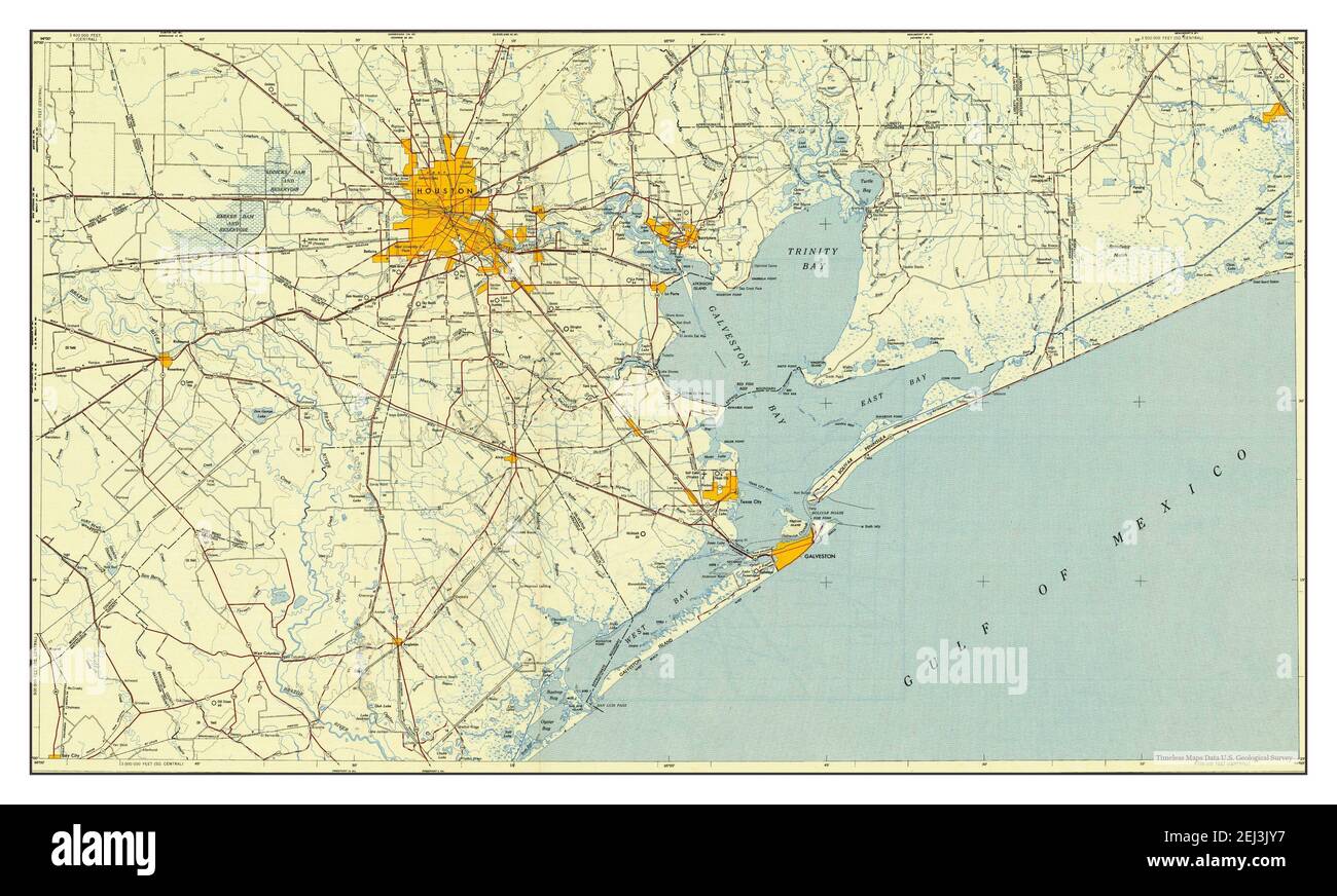
Antique Houston, Texas popular 1956 US Geological Survey Topographic Map – Galveston, Pasadena, Jacinto City, Rosenberg, Bay Town, Gulf of Mexico TX
Beautiful, antique map of Houston, Texas and surrounding area. This is an authentic 1956 edition, 1969 print from the U.S. Geological Survey and NOT a computer reproduction.
See what Texas looked like over 60 years ago. Lots of intricate details and geological contours. Map is incredibly large and in the grand 1:250,000 scale. The USGS cartographers were very thorough back then!
Perfect for the historian, map-lover, the curious or just as a conversation starter. Wonderful and rare. Vintage maps such as these make great gifts.
Edition of 1956, printed 1969
Dimensions: 32" width x 22 1/2" height
----
Features
Cities & Towns: Houston, Galena Park, Richmond, Angleton, Hitchcock, Nederland, Sweeny, Lake Jackson, La Marque, Texas City, Wallisville, Brazoria, Galveston, Pasadena, Jacinto City, Rosenberg, Bay Town.
Points of Interest: Gulf of Mexico, Galveston Bay, Trinity Bay, West Bay, Galveston Island, Lake Houston, Lake George, Brazos River, Wallisville Reservoir, Bolivar Peninsula, Anahuac National Wildlife Refuge, Buffalo Bayou and lots more hills, mountains, rivers, lakes, creeks, roads, highways, railroads.
Condition: Very Good condition, commensurate with age. This map is in incredible shape for being over 50 years old. Has light edge-wear, all of which will read as vintage character when framed.
----
We will happily adjust shipping price for multiple purchases. Maps are popular rolled up and shipped in sturdy mailing tubes, never folded.